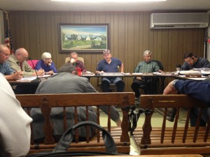
Facing the futility of fighting with FEMA over inaccuracies in its new FEMA flood plain maps, the board will recommend the Town’s amended flood plain zoning by-law as a utilitarian move to prevent adverse impacts to the entire Town.
Leading the fight against the alleged erroneous flood maps, Planning Board member Bill Bailey, who claims his pond-side property is affected by the new maps, conceded that unless he coughs up the money to pay for an engineer to survey the wetlands, he will have to live with the new maps – for now.
Bailey said he and several other town employees attended a meeting with two representatives from FEMA, who admitted that the maps might have errors, but nothing could be done from their end.
According to Bailey, if the Town fails to adopt a flood plain by-law, FEMA would deny Rochester any disaster relief and restrict Rochester residents from the FEMA flood insurance program, thus forcing residents to turn to banks with rates many times higher than FEMA’s subsidized insurance rates.
Bailey said he recently received a letter from another resident affected by the alleged errors on the flood maps, and he stated, “Now I know it’s not just me.”
“We can’t get anything by pushing FEMA,” said Bailey. Even though he said FEMA is violating his rights, he will vote to recommend the article to Town Meeting on May 19 so that the whole Town will not be punished.
Residents with mortgages who find their properties within a new flood zone will now have to purchase flood insurance and may not be able to make any major additions or alterations to their homes. In addition, Bailey said it would be harder for these affected properties to sell in the future.
“As much as it galls me, I don’t really think it’s fair for [other people] to lose their flood insurance,” said Bailey. “It’s wrong.”
After the unanimous vote to recommend the by-law, Chairman Arnold Johnson said, “That one’s a bitter one. We usually don’t operate that way.”
Also during the meeting, engineers and representatives on behalf of Rochester Crossroad, LLC and Colbea Enterprises, LLC met with the board for informal discussions on plans for a commercial development on Cranberry Highway, with a gas station/convenience store sharing an access road in front of the main development.
Minutes before, the board approved an “Approval Not Required” application to carve out a 1.3 acre lot from the Route 58/Route 28 corner of the larger parcel for Colbea to develop for the gas station. The ensuing discussion focused on the relationship between the two sites, most notably the access roadway.
The discussions were lengthy, and the board had several recommendations for the planning phase, including a recommendation that the engineers visit the Cumberland Farms in Marion since some board members were skeptical that the site layout was large enough to accommodate easy ingress and egress to and from the business.
Engineer Erik Smith for Colbea said the layout was “generous” relative to any of the other 115 gas station sites.
After further discussion, Johnson stated that he thinks the site is substantially bigger than Cumberland Farms in Marion.
He later added that the board would not accept any plans until the projects receive approval for required waivers from the Zoning Board of Appeals.
The board suggested a site visit once the location of the proposed road is staked.
In other news, the board approved an Approval Not Required application for Bradford Morse to divide one lot at 209 Pierce Street into two lots.
By Jean Perry

Hello! Nice to be in http://www.wanderer.com!